TEL +82 42 863 4223
FAX +82 42 863 4524
E-MAIL info@contec.kr
- ABOUT US
- SOLUTION
- RECRUIT
- MEMBERSHIP
- PR CENTER
ABOUT US
SOLUTION
RECRUIT
MEMBERSHIP
PR CENTER


Overview
-
To transmit and receive satellite and launch vehicle data, we provide turn-key solutions related to ground station systems, ranging from ground station site selection technology, design, and construction technology, operation and control technology, preventive/failure maintenance technology and integrated operation SW development technology
Ground Station System Design/ Construction
-
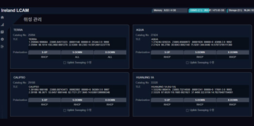
The ground station operation software enables the monitoring, control, and integrated operation of ground RF systems. This service allows the convenient management and operation of ground station RF systems with minimal operational staff. By establishing ground stations worldwide and utilizing ground station operation software, we can track, control, and receive imagery from satellites for global customers.
Key Features
- System Interface Design
-
- Even if the ground station product from the selected vendor meets the requirements, it is crucial to design appropriate interfaces for seamless integration, including those for RF and communication methods.

- Ground Station Construction
-
- Completion of ground station location selection through analysis and followed by the antenna and RF system construction
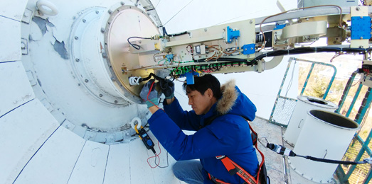
- Performance Verification
-
- Following the construction of a satellite antenna system, performance verification is conducted to ensure that the designed antenna and RF system meet the required performance criteria

- System Operations
-
- Performing all processes necessary for pass execution, including updating orbit information, registering pass plans, and initializing satellite-specific systems
- Providing monitoring for system anomalies and analysis of pass results
Ground Station Construction Site Environment Analysis
-
지상국의 후보지를 선정하기 위하여 환경분석에 기후분석, 가시선 측정, 전파 간섭 측정, 지반조사, 인프라(인공환경) 등을 구축 사이트 확정을 위하여
사전에 실사 및 사후분석을 통한 최적의 솔루션을 제공하고 있습니다. 환경 분석 결과를 토대로 사이트 확정 및 지상국 적의 사이트 운영 환경조건을 만족하는
사이트를 확정하고 있습니다.
Key Features
- Climate Data Analysis
-
- Preliminary investigation of the impact of temperature, humidity, wind, and other factors on potential ground station locations

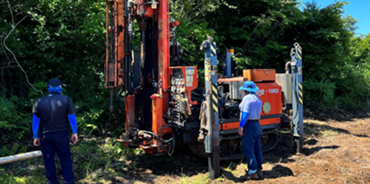
- Geological Survey and Infrastructure (Artificial Environment) Analysis
-
- System analysis of the necessary infrastructure (electricity, communication, roads, etc .) for potential ground station locations
- Se curing samples through ground investigation for the analysis of vertical lithological conditions, crack states, and the distribution of fragmented zones
- Line of Sight
-
- Analyzing and identifying obstacles in the angular direction (azimuth) toward which the satellite is oriented
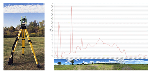
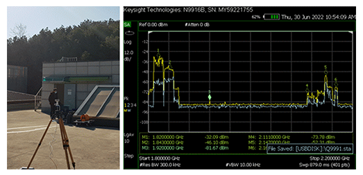
- Radio Frequency Environment analysis
-
- Analysis of the impact of external radio waves through interference and multipath analysis on the transmission/reception of the utilized frequency
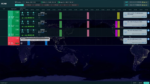
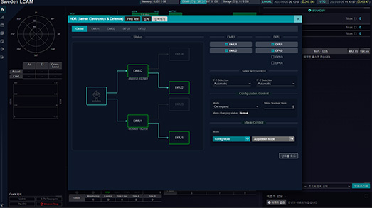
Ground Station Integrated Operation Software
-
In the process of selecting candidate sites for ground stations, we offer optimal solutions through pre-site inspections and post-analysis, encompassing environmental analysis, climate analysis, line-of-sight measurements, radio interference measurements, ground surveys, and infrastructure (artificial environment). Leveraging the results of environmental analysis, we finalize a site that meets the operational environmental conditions for the ground station, ensuring a comprehensive assessment of site suitability
Key Features
- Equipment Control
-
- Integrating equipment interfaces from different manufacturers and providing consistent screen functionality for equipment control
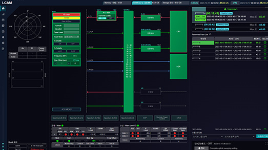
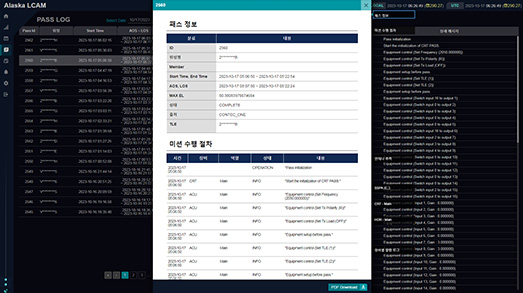
- PASS Execution and Equipment Monitoring
-
- Automatically performing control and image reception according to the PASS schedule requested by the customer
- Post Pass Report
-
- Providing PASS execution results to operators in various formats (reports, PDFs, Excel, etc.)
- Integrated Monitoring
-
- Offering real-time monitoring and management capabilities by consolidating the status of the entire ground station system in one place during operations