
TEL +82 42 863 4223
FAX +82 42 863 4524
E-MAIL info@contec.kr
- ABOUT US
- SOLUTION
- RECRUIT
- MEMBERSHIP
- PR CENTER
ABOUT US
SOLUTION
RECRUIT
MEMBERSHIP
PR CENTER


Overview
-
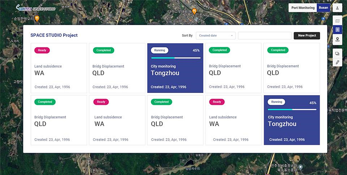
CONTEC offers diverse analysis/utilization service content tailored to user needs, leveraging Space Studio, various satellite data, and AI technology. With Space Studio, you can subscribe to intuitive and user-friendly satellite data analysis/utilization services.
CONTEC Space Studio
- CONTEC Space Studio
-
Key Features
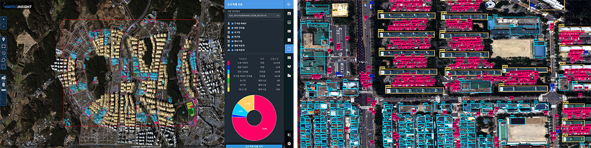
- Smart City
-
- CONTEC provides a Smart City monitoring solution using high-resolution satellite imagery and deep learning technology. CONTEC’s Smart City monitoring solution offers services to monitor urban traffic flow, environmental conditions, and city infrastructure. This enables easy access to essential information for urban planning and resource management.
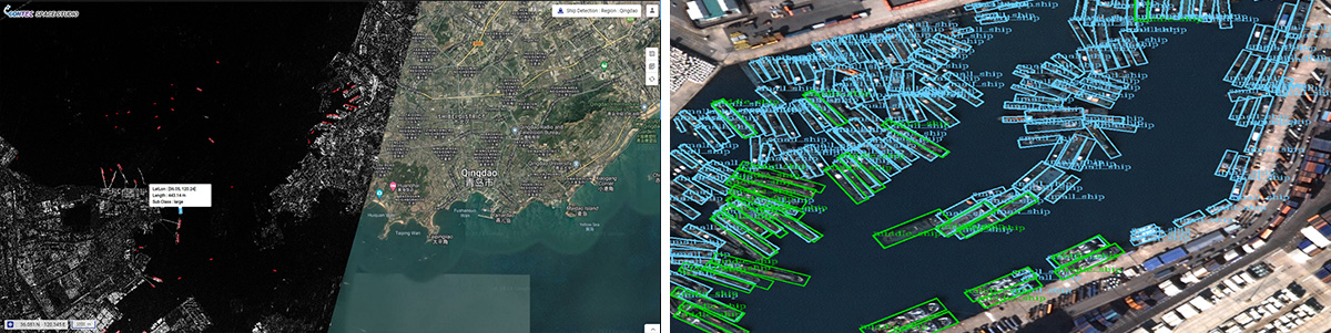
- Maritime
-
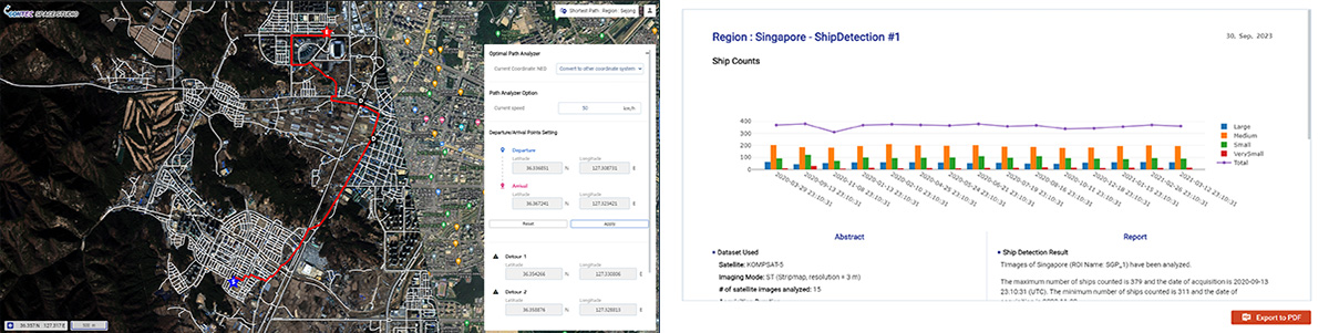
- CONTEC offers a solution for maritime facility detection and smart port management, utilizing SAR (Synthetic Aperture Radar), EO (Electro-Optical) imagery, and deep learning technology. Through CONTEC Space Studio, we conduct ship positioning, monitor the condition of maritime facilities, and perform environmental monitoring in port areas, contributing to enhanced efficiency in maritime resource management and port operations.
- Agriculture / Disaster
-
-
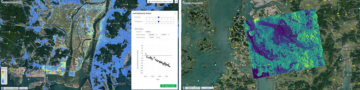
Using SAR (Synthetic Aperture Radar) and EO (Electro-Optical) imagery, we provide agricultural solutions such as crop monitoring, harvest prediction, crop classification, soil moisture analysis, and land-use analysis. Additionally, we offer periodic management solutions for responding to natural disasters, including flood monitoring, typhoon tracking, earthquake response, and groundwater level monitoring.
CONTEC Space Studio monitors crop conditions, supports natural disaster prediction, enhances agricultural productivity, and enables rapid response during disaster situations.
-
Using SAR (Synthetic Aperture Radar) and EO (Electro-Optical) imagery, we provide agricultural solutions such as crop monitoring, harvest prediction, crop classification, soil moisture analysis, and land-use analysis. Additionally, we offer periodic management solutions for responding to natural disasters, including flood monitoring, typhoon tracking, earthquake response, and groundwater level monitoring.
- Defense
-
-
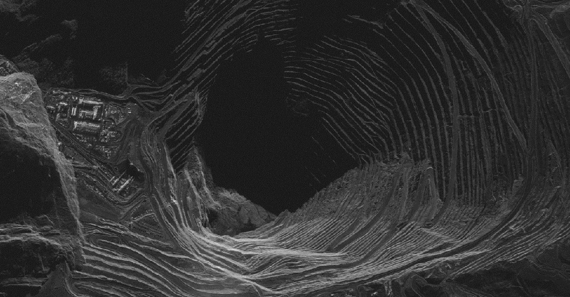
Utilizing SAR (Synthetic Aperture Radar), EO (Electro-Optical) imagery, and deep learning technology, we provide defense solutions for precise target monitoring and operational support, including strategic surveillance.
CONTEC Space Studio, based on diverse data collection for accurate target monitoring, supports appropriate military operations and responses effectively.
-
Utilizing SAR (Synthetic Aperture Radar), EO (Electro-Optical) imagery, and deep learning technology, we provide defense solutions for precise target monitoring and operational support, including strategic surveillance.