TEL +82 42 863 4223
FAX +82 42 863 4524
E-MAIL info@contec.kr
- ABOUT US
- SOLUTION
- RECRUIT
- MEMBERSHIP
- PR CENTER
ABOUT US
SOLUTION
RECRUIT
MEMBERSHIP
PR CENTER


Overview
-
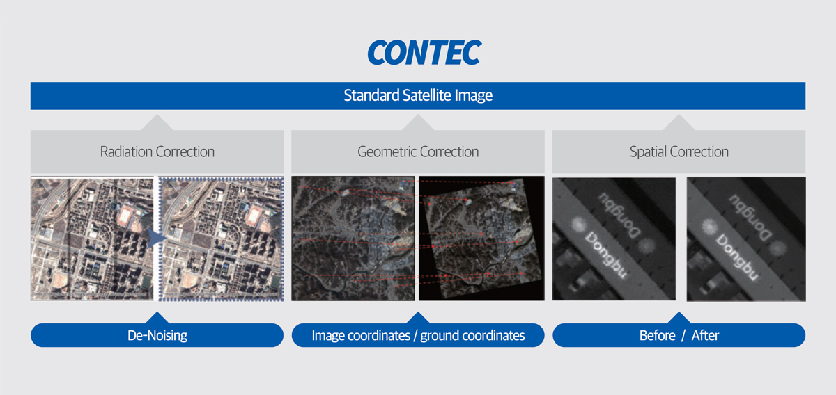
Satellite images are processed on the ground using image processing techniques (radiometric, spatial, geometric) based on the characteristics of satellite systems. This correction adjusts for physical displacement due to the characteristics of the satellite system and distortions caused by orbit, Earth’s curvature, etc., producing standardized image products.
EO Satellite Image
Processsing
-
Applying specialized algorithms to correct distortions in raw image data received from satellites, our satellite image processing technology produces standardized image products. This technology includes radiometric, spatial, and geometric distortion correction for the creation of standard images from satellite data, enhancing overall image quality.
Key Features
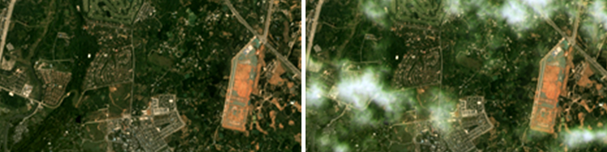
- Satellite Image Haze Removal
-
- Possessing satellite image haze removal technology, we enhance the visibility and quality of degraded satellite images by eliminating haze, a factor affecting the images during satellite capture. This technology aims to improve the overall quality and utility of satellite imagery.
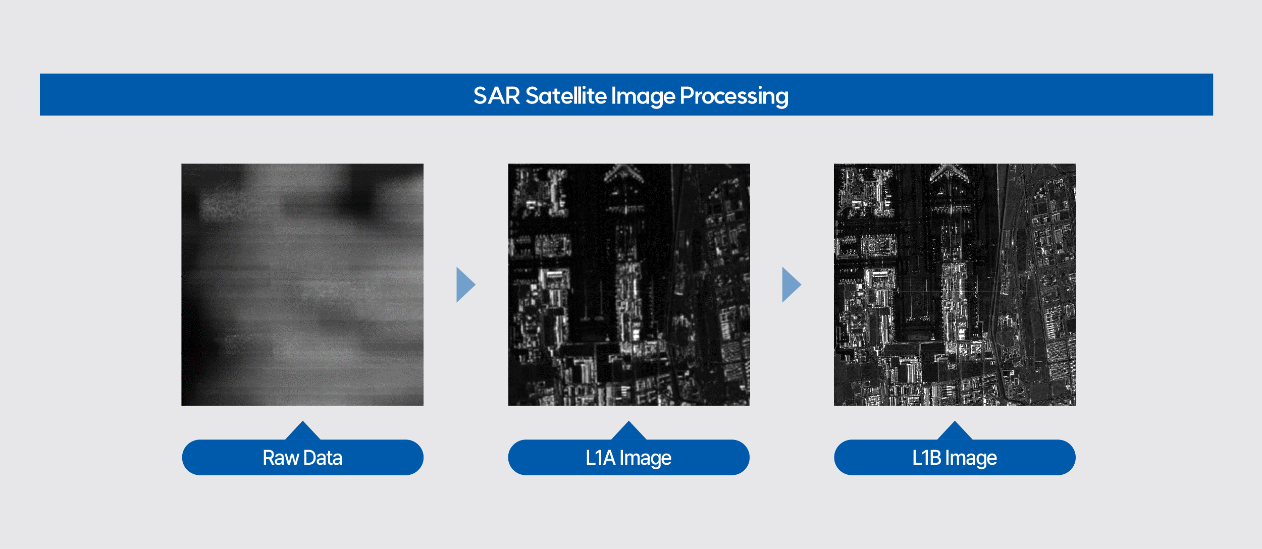
SAR Satellite Image
Processing
-
SAR satellite image processing demands various knowledge and expertise, encompassing the satellite’s orbit, SAR satellite operating modes, and SAR system characteristics. CONTEC offers the advanced CONTEC SAR-P solution, incorporating a crucial precision matching filter for high-resolution image processing in the Azimuth direction. This solution is specifically designed to process Spotlight and Sliding Spotlight images with exceptional precision.
Key Features